
Origin of the names of 63 provinces in Vietnam

Have you ever heard about the origin of the names of 63 provinces and
cities in Vietnam? If not, I will explain to you.
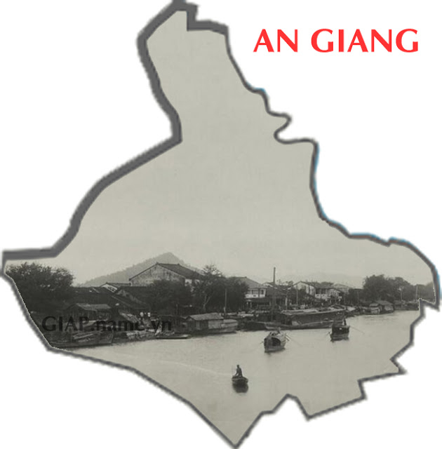
1. An Giang
An Giang was formerly Tam Phong Long land. After that, Chan Lap country offered
to Lord Nguyen, King Gia Long organized people to reclaim and settle them into
one of the six Southern provinces of the independent Nguyen Dynasty. The name An
Giang means a peaceful river for long time settlement, meaning to encourage the
migrants to set up a village.
In the photo is a landscape in Chau Doc taken around 1920-1929, in the far side
is the famous Sam mountain of Chau Doc.
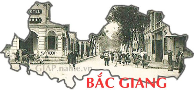
2. Bac Giang
Bac Giang belonged to Vo Ninh county under Hung King's reign of Van Lang, the Ly
- Tran dynasties called the Bac Giang highway, in the Le dynasty it was called
Phu Bac Ha, in 1822 it was changed to Phu Thien Phuc, in the Tu Duc King period
it was Phu Da Phuc. Up to now, no documents have been found to prove, however
the name Bac Giang means north of the river.
In the photo is the center of Phu Lang Thuong, Bac Giang town today, on a
postcard with the marked May 7, 1908.
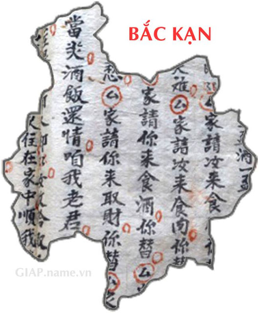
3. Bac Kan
Bac Kan is a mountainous province in the northeastern region of Vietnam. The
article on the stele "Tam Hai Ho Son Chi" in Chinese language engraved on stone
built in Bo Lu, on the bank of Ba Be lake, written by Phan Dinh Hoe. Mr Vi Van
Thuong carved and built the stele in 1925. The word "Kan" in the old Chinese
language means prevent or protect, Bac Kan means protect the north
In the photo, there is a page of the book "Chai Tinh Ky Hoa" in Nom languare of
the Tay ethnic group, which accounts for more than 50% of the population of Bac
Kan province.
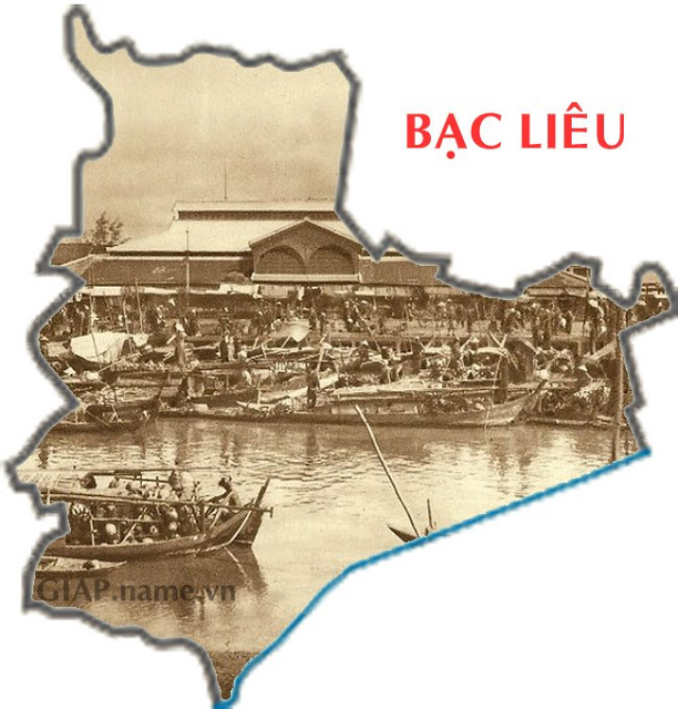
4. Bac Lieu
Bac Lieu is pronounced in Sino-Vietnamese from Chaozhou language as "Po Leo",
which means a poor hamlet, working as a fisherman. Another opinion is that "Po"
is a "bot" or �don� (military station), while "Lieu" means "Lao" (Ai Lao) in the
Khmer language, because before the overseas Chinese came, there was a military
garrison of Laos people. However, there is also an opinion that the name Bac
Lieu comes from the Khmer language as Po Loenh, meaning tall banyan tree.
In the photo is the Bac Lieu market around 1890 - 1910.
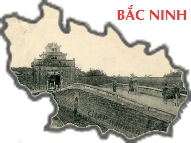
5. Bac Ninh
Bac Ninh province was established by the Nguyen Dynasty in 1822 from a part of
Kinh Bac land. During the Hong Bang period, Van Lang country was divided into 15
ministries, the Vu Ninh ministry was the territory of most of Bac Ninh province
today. The name Bac Ninh may come from Kinh Bac and Vu Ninh. In the photo is the
entrance to Bac Ninh citadel, the first ancient citadel in Vietnam built in a
hexagonal shape, initially it was built with earth, until the sixth year of Kinh
Minh Mang (1825) the citadel was rebuilt by laterite and finally with bricks in
the Thieu Tri dynasty (1841).
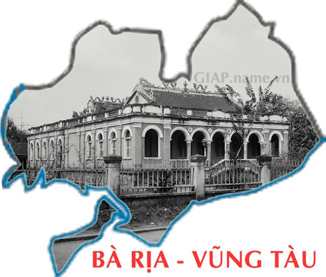
6. Ba Ria - Vung Tau
Ba Ria - Vung Tau is a land combined by Ba Ria and Vung Tau. The name Ba Ria is
a transcription of the name of the Cham Goddess Po Riyak, it may also be a
transcription of madam Nguyen Thi Ria from Phu Yen province, who migrated with
the people in Tran Bien when she was 15 years old, she had great merit in
developing the mountains of forests of Dong Xoai region.
Vung Tau was established in 1895, however, in Le Quy Don's Phu Bien Tap Luc book
in 1776, the word Vung Tau was mentioned: "The begining of Gia Dinh is the land
of Vung Tau, where the island is populated", that was composed of three villages
of Thang Nhat, Thang Nhi, Thang Tam which were established by Lord Nguyen Phuc
Tan in 1658, this land has three sides bordering the sea, very convenient for
ships to park to avoid the wind before entering Gia Dinh, so it is called Vung
(Pool) for Tau (Ships).
In the photo is Ba Ria province taken around 1920-1929.
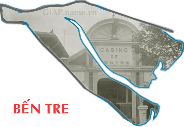
7. Ben Tre
In the old days, according to the book "Monographie De La Province De Ben Tre"
by M�nard in 1903, the Khmer called it Xu Tre because the bamboo grew in
abundance, then people set up a market to trade and call Ben Tre market,
translated as Bamboo dock.
In the photo is the Casino theater in Ben Tre town in the 1920s.
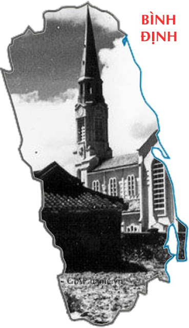
8. Binh Dinh
Binh Dinh was the name given by King Nguyen Anh in 1799 after he defeated Quy
Nhon, Nguyen Anh then renamed Binh Dinh, meant to show the victor's posture,
maybe Nguyen Anh thought he had entered the land of the Tay Son dynasty,
pacified the Tay Son rebels as in the words of the Nguyen Dynasty kings.
In the photo is the Cathedral Church of Quy Nhon Diocese, inaugurated on
December 10, 1939 with the title of Our Lady of the Rosary.
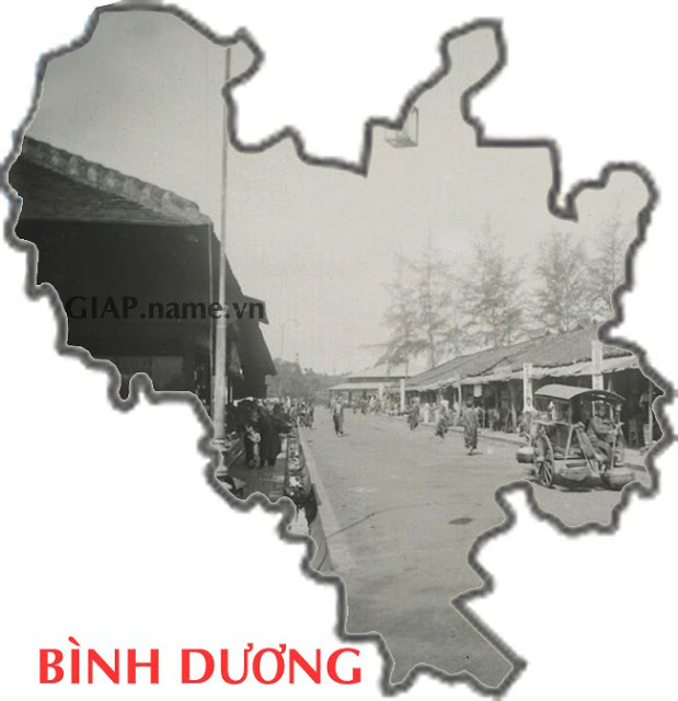
9. Binh Duong
Binh Duong in the old Saigon - Gia Dinh book said that it was taken from the
place of medieval China, where King Nghieu who started up the old Chinese
kingdom. Binh Duong is now part of the old Thu Dau Mot province. Regarding the
name Thu Dau Mot, many people believe that it originates from the Cambodian
language, but other scholars think that Thu Dau Mot is a Vietnamese phrase
formed by the combination of two elements Thu (keep). Dau Mot (land name),
because according to the oral theory, the garrison guard in Binh An is located
on a hill with a large oil tree called "Dau Mot tree", so the name Thu Dau Mot
was born.
In the photo is a row of shopping streets in Thu Dau Mot market around
1920-1929. At this time there was no electricity, each corner of the market had
a street lamp illuminated by kerosene lamps, with a rope hanging on the pulley
to lower the lamp for every night or to add oil. At the end of the road with an
octagonal roof is a fish market, close to the river bank.
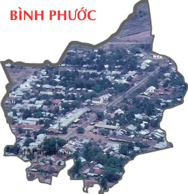
10. Binh Phuoc
Binh Phuoc has its name since January 30, 1971, when the Central Department of
the South issued a resolution to merge the two provinces of Binh Long and Phuoc
Long into a unit directly under the Central Department.
In the photo is An Loc town around 1970, in Binh Long province, photo of Bill
Flora.
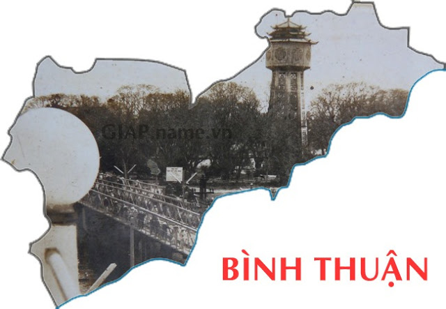
11. Binh Thuan
Binh Thuan is a name dating back to 1697, when Lord Nguyen established Binh
Thuan Phu, including 2 districts An Phuoc and Hoa Da. "Binh" means the discovery
and pacification of a land, Thuan is the peaceful life between the two ethnic
groups of Champa and Kinh, because this land is not stable at this time, so Lord
Nguyen named it. In 1827, during the reign of Emperor Minh Mang, Binh Thuan was
set up as a province.
In the photo, on the right is the Phan Thiet water tower on the left bank of the
Ca Ty river, starting construction in late 1928, completed in early 1934.
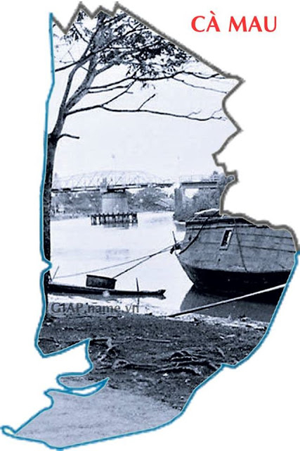
12. Ca Mau
Ca Mau is a name formed by the Khmer people calling this land "Tuk Kha-mau",
meaning black water, because the cajuput leaves of the U Minh cajuput forest
changed the color of the water. Ca Mau is a wetland land, with many bushes
growing naturally and wild. That is why, since ancient times, there has been a
saying: "Ca Mau is a country land / Mosquito is as big as chickens, tigers hunt
buffaloes".
In the far part of the photo is the Ca Mau turning bridge, around 1940, now it
is the section of Ca Mau Water Supply Joint Stock Company).
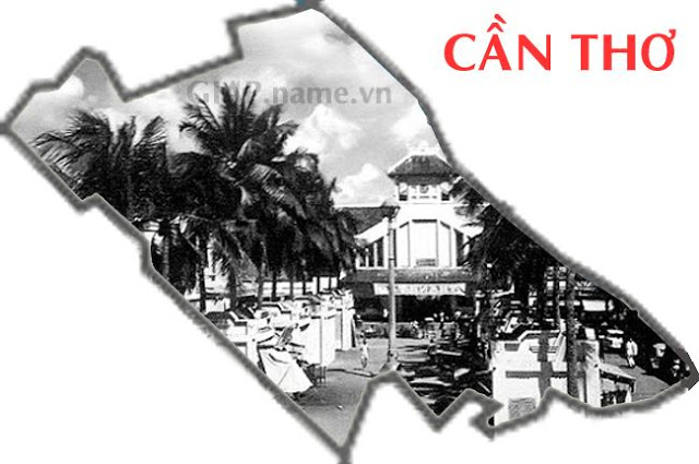
13. Can Tho
Can Tho is a place when compared to the original Khmer name of this area, Prek
Rusey (Bamboo River), which has no phonetic relevance, but before, there was a
canal named after a fish as kyntho in the Khmer language, later turned into
Can
Tho. Can Tho province itself was established on January 1, 1900 under the French
colonial rule, after that, it was split, merged and moved geographically many
times.
In the photo is Hang Dua market taken in 1955, now it is Can Tho market.
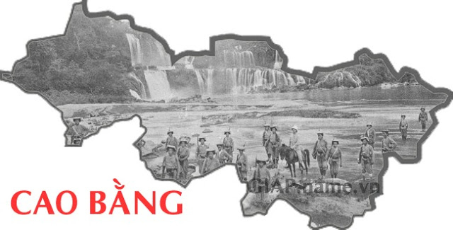
14. Cao Bang
Cao Bang belonged to the Vu Dinh district under the Hung Vuong times, from the
Ly dynasty it belonged to Thai Nguyen land. In 1467 it was called Phu Bac Binh
(Bac Binh district), and later it was changed to Cao Binh. In 1676, the Le
dynasty recovered from the Mac's hands and renamed it Cao Binh town. During the
Tay Son dynasty, the name Cao Binh gradually misspelled as Cao Bang until now.
In the photo is Ban Gioc waterfall in the French colonial period with a group of
French trainees and commanders (riding horses) taken by the waterfall.
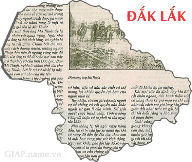
15. Dak Lak
Dak Lak is named after the M'Nong language meaning "Lak lake", with dak meaning
"water" or "lake". Dak Lak is considered one of the cradles nurturing the
Central Highlands gong culture, recognized by UNESCO as the world's oral
masterpiece and intangible value.
In the photo is the press article about the funeral of Mr. Ama Thuot, a famous
chief of the ancient Ede ethnic, died in 1923.
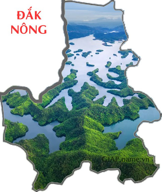
16. Dak Nong
Dak Nong in the M'Nong language means Water (or land) of the M'Nong people. Dak
Nong is located at the southwest gate of the Central Highlands, in the north and
northeast bordering the territory of Dak Lak province, the east and southeast
bordering Lam Dong province, the south bordering Binh Phuoc province, the west
bordering the Kingdom of Cambodia.
In the photo is Ta Dung lake, considered as Halong bay of the Central Highlands.
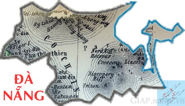
17. Da Nang
Da Nang is the mispelled name of the ancient Cham word Daknan. "Dak" means
water, "nan" is wide. Daknan implies the immense river area at the mouth of the
Han River. Some researchers believe that "Da Nang" may come from the Mon-Khmer
language group, Dakdong - Da Duong, which means the river source.
In the photo is the Hoang Sa archipelago on a map of Germany in 1876 with the
statement clearly that the archipelago belongs to the land of "Annam".
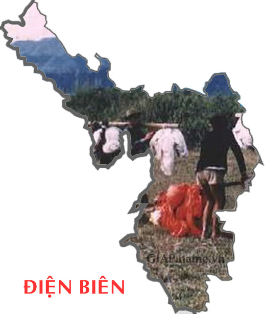
18. Dien Bien
Dien Bien is an ancient land. Dien Bien Phu was originally called Muong Thanh,
from the word Muong Then in the Thai language, meaning heaven place. This is
considered a sacred land in the remote region, according to ancient beliefs, it
is a place of heaven and earth. The name Phu Dien Bien, or Dien Bien Phu was
given by King Thieu Tri in 1841, in this sense the word Dien means a large
mountainous area but sacred land, a shrine, Bien mean border.
In the picture are Thai ethnic people collecting parachutes of the French at
Dien Bien Phu battlefield in 1953-1954.
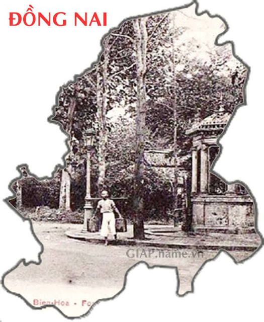
19. Dong Nai
Dong Nai's original name is still unclear. Local theory says this area used to
be a field with many deer. There is also an opinion that the word Dong in Dong
Nai is the phonetic form of the word Đường in Đạ Đ�ng (Song Cai) of the Ma
people; because there are many other names derived from the word Dong (Duong)
but not the field: Dong Tranh, Dong Mon, Dong Tram, Dong Truong...In the 17th
century, Dong Nai or the land of Dong. Nai refers to a large area of the South
Vietnam now.
In the photo is Ken citadel, in December 1861, the ancient citadel of Bien Hoa
fell into the hands of the French colonialists, the French army rebuilt the
citadel, reduced it to 1/8 compared to before and called the "Petrolium" (Soldat
), means to be a soldier. In the morning, soldiers often used alarm bells, the
sound echoes the whole area, so the local people call it "Ken Citadel".
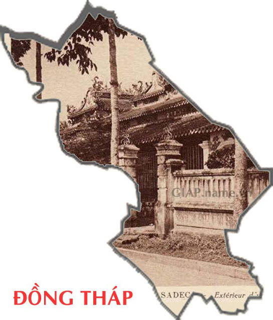
20. Dong Thap
Dong Thap has its name from Dong Thap Muoi, written documents are written "dong
Thap Muoi" (without capital letter D), which means "10th tower" or "10-storey
tower", there are even different explainations about the meanings above. Many
people believe that the name of Thap Muoi was formed and transformed as follows:
Thap Muoi -> Thap Muoi mound (Go Thap for short) -> dong Thap Muoi -> Dong Thap
Muoi area -> Thap Muoi + Dong Thap.
In the photo is Vinh Phuoc communal house, built in 1807, worshiping the
superior god Tong Phuoc Hoa.
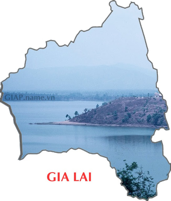
21. Gia Lai
Gia Lai's name originates from the Jarai word, the name of an indigenous ethnic
group with the largest population in the province. This land is Jarai, Charay,
Ya-Ray means the land of the Jarai people, possibly referring to the land of
Thuy Xa and Hoa Xa in the old Jarai state.
In the photo is T'nung lake in 1969, also known as Bien Ho, Ea Nueng Lake... is
a freshwater lake located in the northwest of Pleiku town.
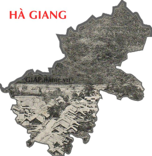
22. Ha Giang
Ha Giang, according to literal interpretation, is a small river flowing into a
large stream.
In the photo is the town of Ha Giang around 1910, the far side is Cam mountain,
at the foot of the mountain are busy streets with crowded population.
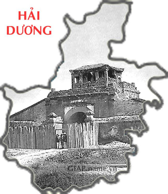
23. Hai Duong
Hai Duong has it's official name since 1469, Hai means the coastal area, the
land bordering the sea, Duong means the the light of the sun. Hai Duong is
located in the east of Thang Long capital city. East direction is also the
direction of sunrise. So Hai Duong means "the sun of the East Sea" or "light
coming from the coast (east)". In "Du Dia Chi" book, Nguyen Trai evaluated Hai
Duong as the first of the four towns and the eastern fence of Thang Long
citadel.
In the photo is Hai Duong citadel or Thanh Dong in 1885, one of the four towns
of Thang Long capital.
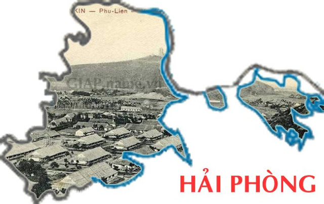
24. Hai Phong
Hai Phong is also known as Dat Cang, or Port City, Red Flower City, founded in
1888. The name Hai Phong can be shortened in the phrase "Hai Tan phong thu"
(defense the sea) of female general Le Chan, or from a shortened name of a state
agency in Tu Duc dynasty in Hai Duong: Hai Duong Thuong Chinh Quan Phong (Hai
Duong commercial and administrative office), it can also be founded as Hai Phong
garrison by Bui Vien in 1871 under Tu Duc dynasty.
In the photo is a panoramic view of ancient Kien An town, seen from Dau Dong
mountain. Military barracks are located at the foot of the mountain, the far
side is Thien Van mountain, the name originates from the observatory built by
the French in 1902 on the top of the mountain. Kien An is located in the valley
of Thien Van mountain ranges (or Dau Son) and Cot Co mountain (or Phu Lien).
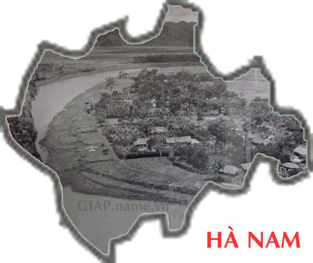
25. Ha Nam
Ha Nam was established in 1890, Nam Dinh was divided from Thai Binh province and
a part of the northern area to form Ha Nam province with the southern part of
Hanoi. Ha is taken from H� Nội, and Nam is from Nam Dinh.
In the photo is the Day River flowing through Kim Bang district Ha Nam in 1950.
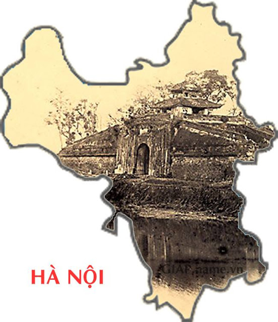
26. Ha Noi
Ha Noi was Thang Long, ancient Dong Do changed its name in 1831 under the reign
of Emperor Minh Mang.
Ha Noi means inside the river, Ha Noi is surrounded by two
rivers: the Red River and the Day River.
In the photo is Cua Bac, or Chinh Bac Mon gate, one of the five gates of Ha Noi
in the Nguyen Dynasty. When the French destroyed Hanoi citadel, they kept the
North gate because there were two traces of cannons fired by the French from the
Red River in 1882 when the French beat Hanoi citadel for the second time. Today,
on the gate is the place to worship the two Hanoi governors Nguyen Tri Phuong
and Hoang Dieu.
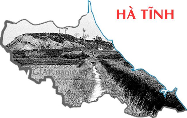
27. Ha Tinh
Ha Tinh has its name since 1831, when King Minh Mang split Nghe Tinh into 2
provinces Nghe An and Ha Tinh.
In the photo is the area of Mount Nai in 1975.
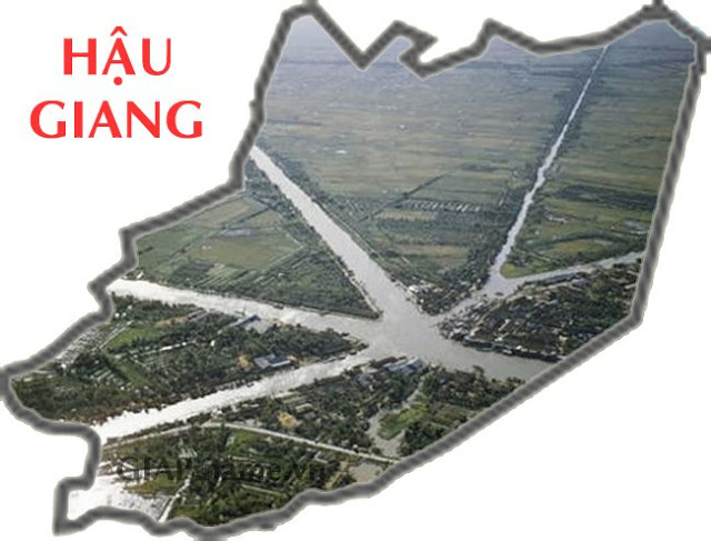
28. Hau Giang
Hau Giang is a place where it's name originates from the name of the Hau River.
In 1976, there was also a Hau Giang province in the southwestern region,
dissolved in 1991 due to being divided into Can Tho province and Soc Trang
province, then in 2004 Can Tho province was divided into the city of Can Tho
directly under the central government. and present Hau Giang province.
In the photo is the area of Nga Bay floating market taken from above, in 1961.
29. Hoa Binh
Hoa Binh is a province established in 1886 under the decree of Kinh Luoc Bac Ky
(northern governor) with the name Muong province. The provincial capital is
located in Cho Bo township, so it is also called Cho Bo province. At the end of
1886 it was moved to Phuong Lam commune, in 1888 it was renamed as Phuong Lam
province. In 1896 the provincial capital was moved to Hoa Binh commune, on the
left bank of Da river, opposite Phuong Lam and since then called Hoa Binh
province.
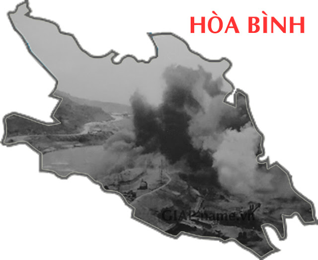
In the photo is the documentary image of the construction of Hoa Binh hydropower
plant in 1979.
30. Hung Yen
Hung Yen has the meaning of prosperity and peace, the province was established
in 1831 including the districts of Dong Yen, Kim Dong, Thien Thi, Tien Lu, Phu
Dung of Son Nam and Than Khe towns, Hung Nhan, Duyen Ha of Nam Dinh town. The
Hung Yen land was famous from the Trinh - Nguyen war because of Pho Hien, the
folk has a saying "First Kinh Ky (Ha Noi capital), second Pho Hien".
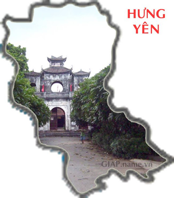
In the photo, Xich Dang temple was built around in 1701, to worship Chu Van An -
a talented and righteous teacher in the Tran Dynasty.
31. Khanh Hoa
Khanh Hoa province was established in 1831 from Binh Hoa town, while Binh Hoa
then became Ninh Hoa town. Khanh Hoa is an old part of Kauthara land belonging
to the Champa kingdom. In 1653, taking the excuse of King Chiem Thanh - Ba Tam
harassing the Vietnamese people in Phu Yen, Lord Nguyen Phuc Tan sent the
governor of Hung Loc to bring troops to conquer the land from Phan Rang to Phu
Yen. In the old Chinese, the word "Khanh" is related to mood, emotion,
personality...the original meaning is "congratulation", the word Hoa is roughly
understood as consensus and harmony.
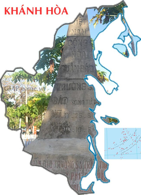
In the photo is a national monument, the sovereignty stele of Truong Sa
archipelago of Vietnam built in 1956: �Truong Sa archipelago belongs to Phuoc
Tuy province. The military mission surveyed visited the archipelago on August
22, 1956 under the direction of the Vietnamese Navy �.
32. Kien Giang
Kien Giang province was established in 1975, mostly in the area of old Ha Tien
town, discovered by Mac Cuu in the seventeenth century. The name Kien Giang can
be derived from the name of a river in Rach Gia, which is the Kien river.
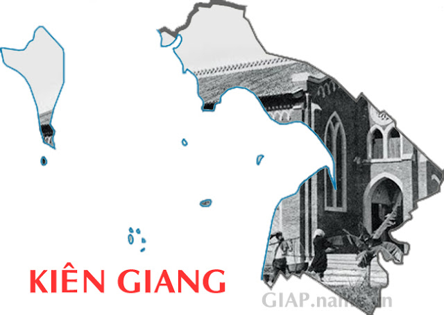
In the photo is the Rach Gia church in 1926, at this time not completed (no bell
tower).
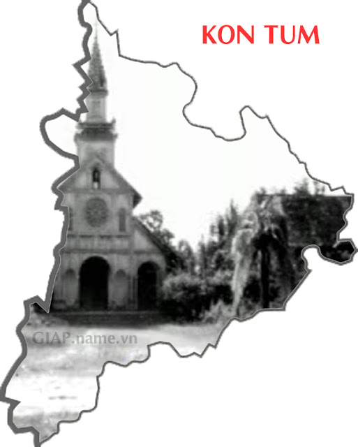
33. Kon Tum
Kon Tum, according to the Ba Na language, Kon is a village, Tum is a lake, Kon
Tum refers to the name of a village near a lake next to the Dak Bla river, which
is now Kon Ko Nam village in Kon Tum city.
In the photo is the cathedral in Kon Tum, taken from the video Kontum et de sa
region prises en 1947 by Michel Grisey.
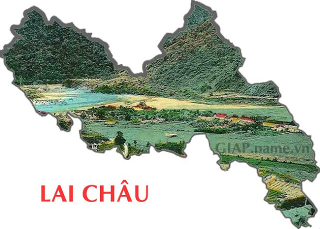
34. Lai Chau
Lai Chau's name comes from the Chau Lay words. At the beginning of the tenth
century, the Thai rulers who occupied this land named it Muong Lay. In 1435,
Nguyen Trai's Du Dia Chi book called it Chau Lai due to the transcription of
Lay.
In the photo is a view of Lai Chau from above, taken by the author Vo An Ninh
(1907-2009).
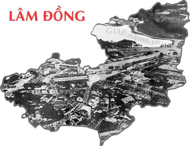
35. Lam Dong
Lam Dong was established from the merger of Lam Vien province with Dong Nai
Thuong province.
In the photo is an image of Da Lat taken from above in 1960, this is the first
photo of Da Lat taken from an airplane, the photographer is Mr. Tran Van Chau.
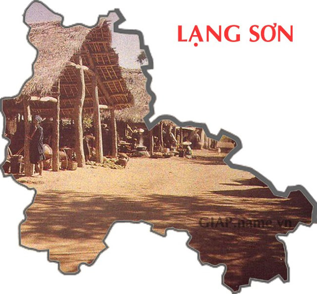
36. Lang Son
Lang Son is one of 13 provinces first established by King Minh Mang in Bac Ky
(northern Vietnam) in 1831, its name comes from "Lang country".
In the photo is Bac Le market now in Tan Thanh commune, Huu Lung district, Lang
Son province, taken in 1915.
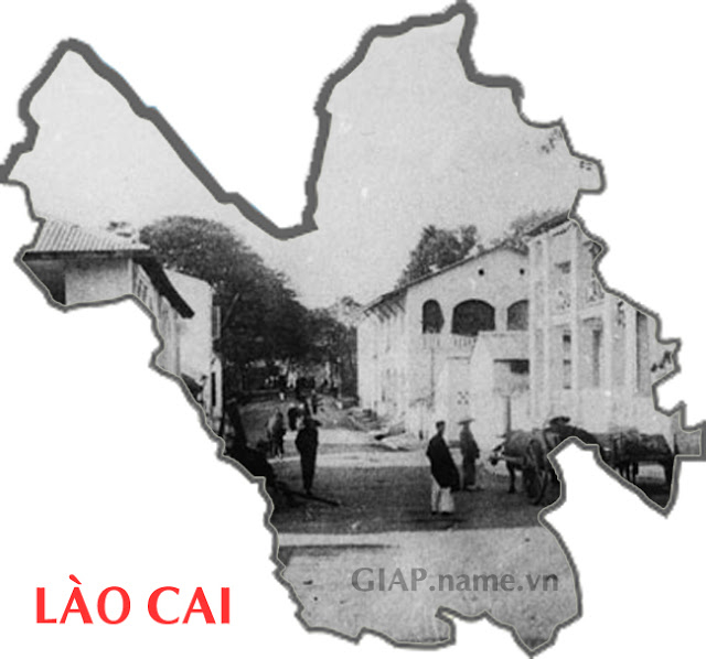
37. Lao Cai
Lao Cai is the pronunciation of local people reading Lao Nhai meaning Old Street
or Old Market. Local people often call Bao Thang, a neighborhood built by Luu
Vinh Phuc located in the area of present-day Lao Cai town by the name of Lao
Kay, then the French also transcripted that name in Latin as Lao Kai or Lao Kay.
In the photo is a small street in the area of Coc Luu during the French colonial
period.
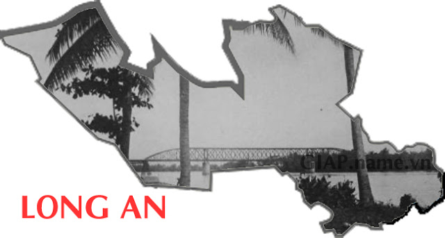
38. Long An
Long An is a place that is understood in the sense: An is peaceful and safe.
Long is flourishing, beautiful.
In the photo is the Eiffel Iron Bridge, in 1930, at this time there was no Tan
An bridge.
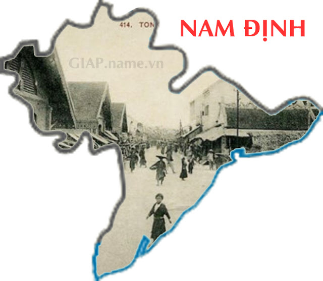
39. Nam Dinh
Nam Dinh has its name originated in 1822, when the Nguyen Dynasty changed the
name of Son Nam Ha town to Nam Dinh town, the word Nam from the Le dynasty means
the South and of the word Dinh means pacification, which was the name Nguyen
dynasty gave to many lands. In 1832 Nam Dinh town was to Nam Dinh province
(including Thai Binh and a part of present Ha Nam land). In 1890, Thai Binh
split into a separate province and a northern part of Nam Dinh split to form Ha
Nam province with a southern part of Hanoi.
In the photo is Nam Dinh market around 1900-1910.
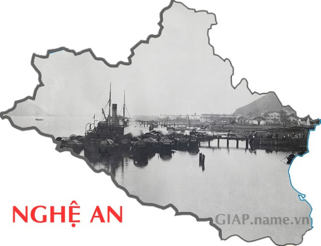
40. Nghe An
Nghe An is a name dating back to 1030 in the Ly dynasty, the 2nd Thien Thanh
year of Ly Thai Tong dynasty, at that time it was called Nghe An Chau camp,
together with Ha Tinh, it had the same common name as Hoan Chau during the
Northern colonial period. King Le Thanh Tong changed it to Nghe, then Nghe An
town. In 1831, King Minh Mang divided Nghe An town into two provinces: Nghe An
and Ha Tinh.
In the photo is a panoramic view of Ben Thuy around 1920-1929.
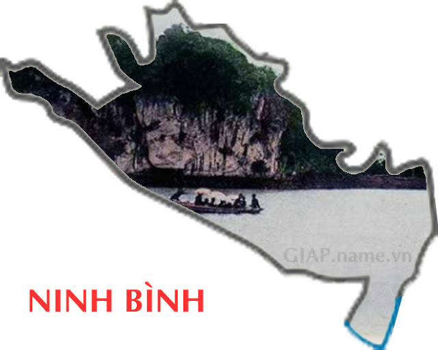
41. Ninh Binh
Ninh Binh means peaceful and quiet. It has been named Ninh Binh religion since
1822, in 1831 it was changed to Ninh Binh province.
In the photo is an image of Ninh Binh on a postcard during the French colonial
period.
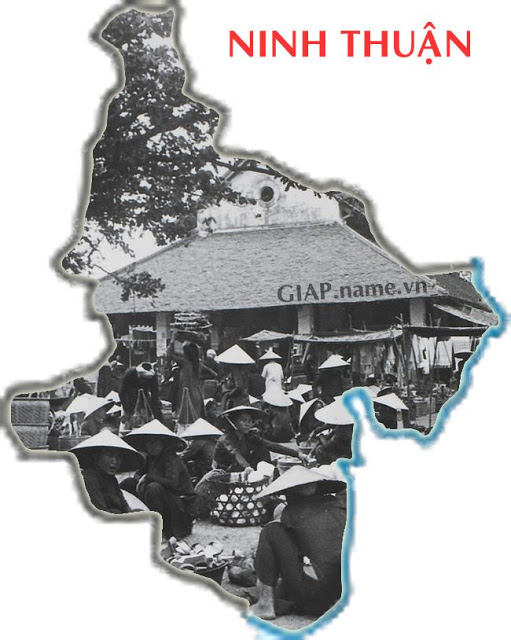
42. Ninh Thuan
Ninh Thuan is the name that first appeared as the Ninh Thuan town in 1832 under
the reign of Emperor Minh Mang, and lasted until 1888. After that, Phan Rang
province was established, also called Ninh Thuan province. From 1945 till now it
has been renamed several times.
In the photo is Phan Rang market around 1900-1930.
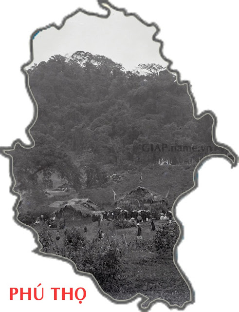
43. Phu Tho
Phu Tho is the name derived from the name of Phu Tho village in Yen Phu county,
Son Vi district, Hung Hoa province that established Phu Tho town in 1903. After
that, the French moved the capital of Hung Hoa province to Phu Tho town and
renamed Hung Hoa province to Phu Tho province.
In the photo is the panoramic view of Nghia Linh Mountain, where Hung Temple is
located during a festival, around 1920-1929.
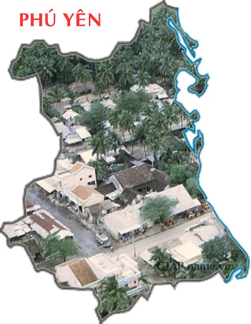
44. Phu Yen
Phu Yen was under the management of the Cham Pa with the name Ayaru until 1471,
King Le Thanh Tong personally took the army to fight Cham Pa until Ca pass, then
merged the land from Hai Van pass to Cu Mong pass (north of Phu Yen) into Dai
Viet territory, from where Ayaru was a place of frequent disputes between the
Vietnamese and the Cham. In 1611, Nguyen Hoang sent his general to attack
Aryaru, Champa kingdom lost and Nguyen Hoang merged Ayaru into the territory of
Dang Trong (south of Phu Yen) under the name Phu Yen, with the wish for a rich
and peaceful land in the future.
In the photo is Song Cau town in 1970.
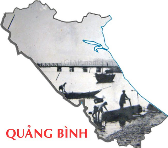
45. Quang Binh
Quang Binh is the land named by Lord Nguyen Hoang since 1558, the old names of
this area include: Bo Chinh, Tan Binh, Lam Binh, Tien Binh, Tay Binh. The name
of Tien Binh in Le Trung Hung's time was Tien Binh. In 1604, it was renamed Quang Binh province, in which Quang means large land.
In the photo is Dai bridge, taken in 1964.
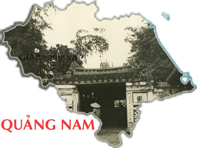
46. Quang Nam
Quang Nam means of expanding to the south. It can be seen that the Central
region many provinces have the word Quang in the names. Because this is a narrow
strip of land, the naming of Quang is expected to be large and immense.
In the photo is the entrance to the Covered Bridge, a symbolic work of the
ancient town of Hoi An, around 1940s, photo by reporter of Life magazine.
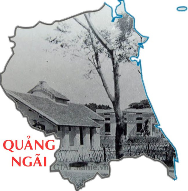
47. Quang Ngai
Quang Ngai may be the name that has the meaning of a strip of gratitude. In 1602
Quang Nam town was changed to Quang Nam palace, Tu Nghia palace that belonged to
Quang Nam palace was changed to Quang Nghia palace. In 1807, Cu Mong commune
(later Chanh Mong and Chanh Lo) was chosen as the construction site of Quang
Nghia province. In 1832, Quang Nghia province, or Ngai province was established.
In the photo is a hospital in Quang Ngai during the French colonial period, in
the book Mes Trois ans d'Annam by French author Gabrielle M. Vassal, published
in 1911.
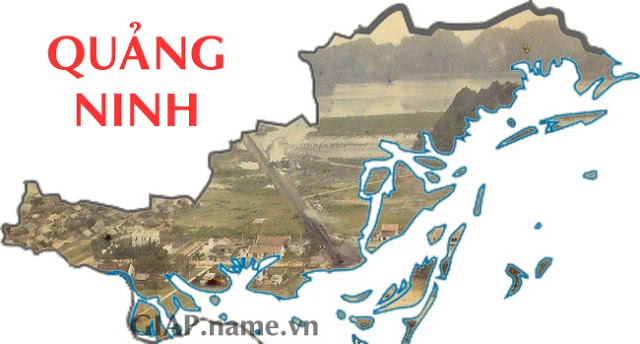
48. Quang Ninh
Quang Ninh is a land of long history. In the area of Ha Long Bay, archaeological
relics of the prehistoric people from 3000 - 1500 BC. When the first Vietnamese
State was formed, during the Hung Vuong period, the land of Quang Ninh was now
the Luc Hai district. One of the 15 districts of Van Lang state. In the feudal
period, the area of Quang Ninh province is now named: Luc Chau, Dong Hai county,
Hai Dong county, An Bang county, Quang Yen province. Later, Quang Yen was split
into many other units, including Hai Ninh, later Quang Yen together with Hai
Ninh and these units merged into Quang Ninh now. Thus, Quang Ninh province is
now almost the old Quang Yen province.
In the photo is Hon Gai, taken in 1915.
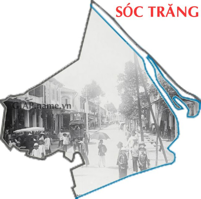
49. Soc Trang
Soc Trang is a name which comes from the Khmer word "Srock Khleang". Srock means
land, Khleang is the king's gold storehouse. Previously, the Vietnamese wrote it
as Soc Kha Lang, and later later it became Soc Trang. The name Shock Trang has
been completely transformed several times. During the king Ming Mang period, it
was changed to Nguyet Giang province, which means moon river (Srock means river,
Sino-Vietnamese is Giang; Trang is moon).
In the photo is the main street in Soc Trang around 1920-1929, now it is Hai Ba
Trung.
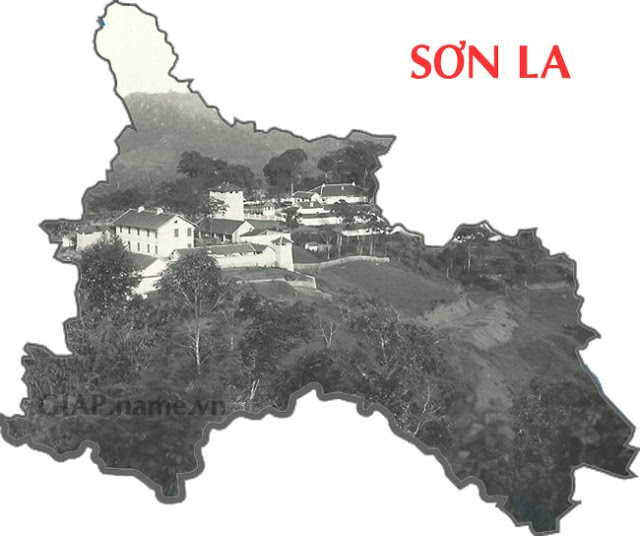
50. Son La
Son La's name comes from the origin of Nam La, a secondary tributary of the Da
River. Son La before 1479 was largely the territory of the kingdom of Bon Man,
which was officially merged into Dai Viet in 1749. In 1886, Son La district was
established under Gia Hung town, Hung Hoa province. In 1895, Van Bu province was
established, the capital was located in Ta Bu, on August 23, 1904, was renamed
Son La province.
In the photo is the panorama of French works on Khau Ca hill, Son La, about
1930-1940.
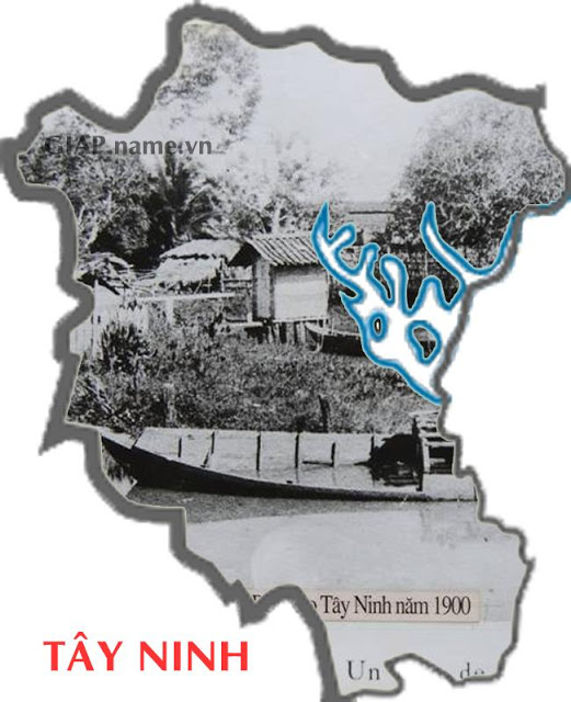
51. Tay Ninh
Tay Ninh from ancient times was originally a land belonging to Thuy Chan Lap,
with the name Romdum Ray, which means "Elephant shed" because there are only
dense forests with all kinds of wild animals such as tigers, elephants,
leopards, snakes. The name Tay Ninh means political peace in the west.
In the photo is the Keo wharf in 1900, located on Highway 22, heading to Saigon,
about 8km away from the city center of Tay Ninh.
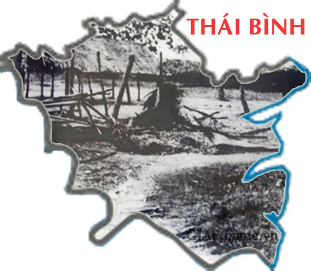
52. Thai Binh
Thai Binh with the name of Thai Binh district, including most of the land of
Thai Binh province dating back to 1005 with the event of changing the name of
Dang Chau to Thai Binh district. On March 21, 1890, Governor General of
Indochina issued a decree taking Kien Xuong palace to separate from Nam Dinh
province and Than Khe district from Hung Yen province and merged with Thai Binh
district to form Thai Binh province.
In the photo is a scene of a market in Thai Binh in 1945, photo by Vo An Ninh.
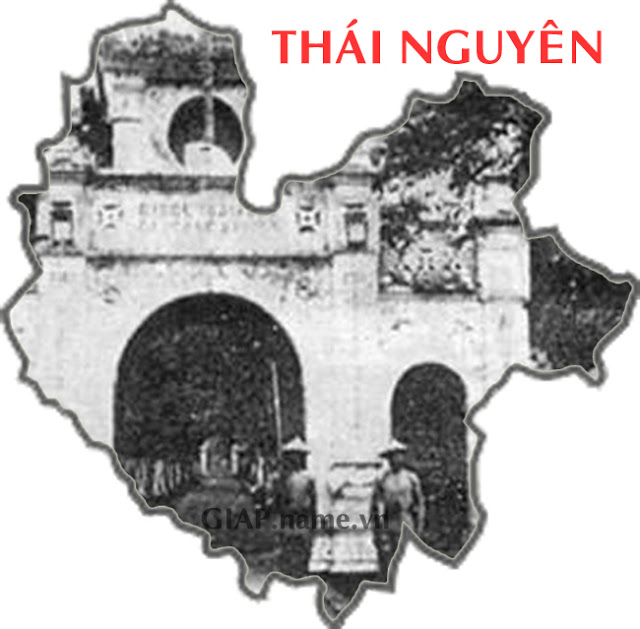
53. Thai Nguyen
Thai Nguyen is a name derived from Sino-Vietnamese language, Thai means large or
spacious, Nguyen means field or large and flat land. The province was
established in 1831, in 1890 the French government divided Thai Nguyen province
into two provinces of Thai Nguyen and Bac Kan. In 1965, the Government of the
Democratic Republic of Vietnam merged two provinces with the name Bac Thai. In
1996, Bac Thai was divided into Bac Kan and Thai Nguyen provinces. Thus, Thai
Nguyen was established by almost the entire old Bac Thai province.
In the photo is the gate of a military camp in Thai Nguyen province, where the
Thai Nguyen uprising took place in 1917.
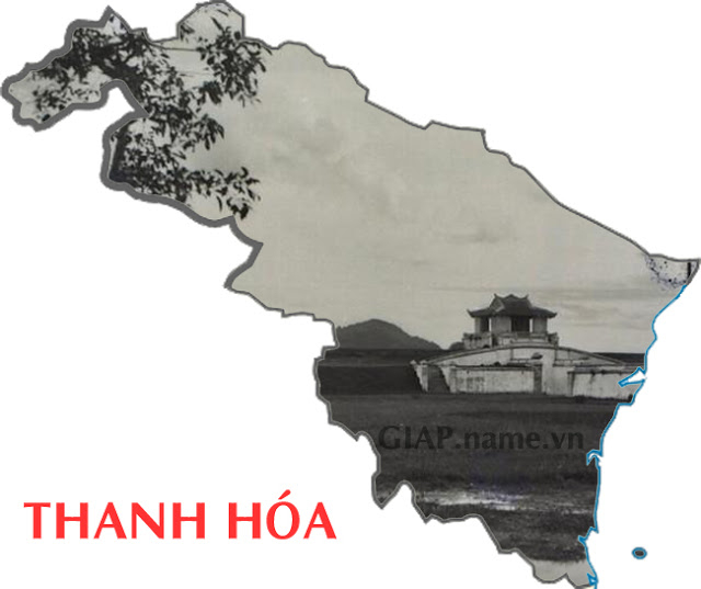
54. Thanh Hoa
Thanh Hoa province is the transitional land between North and Central Vietnam,
it is the province with the least number of mergers and divisions in the
country. During the Dinh and Tien Le dynasties Thanh Hoa was called Ai Chau. In
the Ly Dynasty, the early period was called Ai Chau camp, in Thuan Thien 1 year,
it was 1009 called Phu Thanh Hoa. In 1469 it changed to Thua Tuyen Thanh Hoa,
the name Thanh Hoa appeared since then. In 1802, it was renamed Thanh Hoa town,
possibly because the old name coincided with the name of a concubine of the
king. In 1831, the town was changed to a province, and it was called Thanh Hoa
province. In 1841 it changed to Thanh Hoa province until today.
In the photo is Tho Hac citadel, built under the reign of Kings Gia Long and
Minh Mang, taken around 1920-1929.
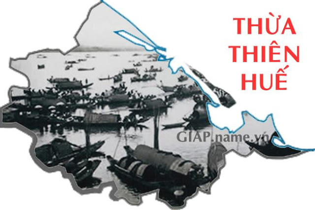
55. Thua Thien Hue
Thua Thien Hue was Phu Xuan district under the Tay Son dynasty. When King Gia
Long divided the country into 23 towns and four palaces, present-day
Thua Thien
Hue belonged to Quang Duc palace. In 1822, Quang Duc palace was renamed Thua
Thien palace by King Minh Mang. From 1831-1832, King Minh Mang divided the whole
country into 31 administrative units including 30 provinces and one district,
Thua Thien. Along with the ups and downs according to the historical flow, the
name and administrative boundary of the province have changed in different
historical periods and have been stable with the name of Thua Thien Hue and the
boundary from 1989 till now.
In the photo is the Perfume River on the death of King Khai Dinh, November 6,
1925.
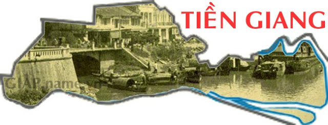
56. Tien Giang
Tien Giang is a land named after the Tien River, the land of which the
Vietnamese mostly from Ngu Quang region settled in the 17th century. After many
changes of name and geographical area, until 1976, the official name was Tien
Giang province on the basis of merging My Tho province, Go Cong province and My
Tho town.
In the photo is My Tho town taken in 1910, in the 17th century, My Tho was
one of the two largest commercial centers in the South at that time along with
Gia Dinh - Saigon.
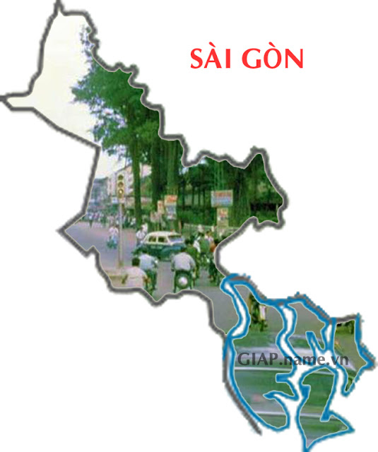
57. Ho Chi Minh city
Ho Chi Minh City is still popularly known with its old name Saigon. There are
many theories about the Saigon name, but the most plausible theory is the Brai
Nagara origin. In the 18th century, the old Gia Dinh region had two places,
Rai-gon thong (Upper Saigon) and Rai-gon ha (Lower Saigon). The origin of the
Rai gon is Brai Nagara or Prey Nokor. Moreover, this name has no meaning in
Vietnamese, so the ability to translate words from other ethnic groups is
understandable.
In the photo is the intersection of Gia Dinh, Le Van Duyet - Chi Lang - Bach
Dang, now Phan Dang Luu - Bach Dang - Dinh Tien Hoang.
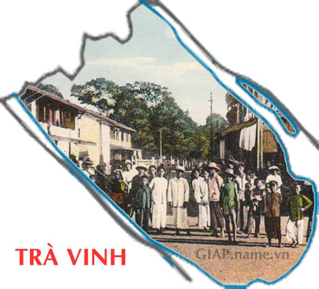
58. Tra Vinh
Tra Vinh is a place of Khmer origin with its initial name Tra Vang which can be
a variation of the word "prha trapenh" which means pond, Buddha pond or sacred
pond. Because it is believed that in the old days, people dug and found a Buddha
statue in a pond in this land. During the Nguyen dynasty, Tra Vinh was the
district capital of Lac Hoa district, Vinh Long province, established in 1832.
In the photo are traders taken in 1925 in Tra Vinh.
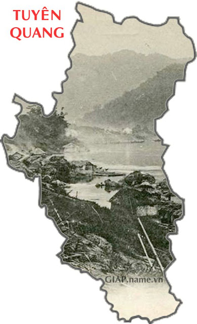
59. Tuyen Quang
Tuyen Quang's name originated from the Tuyen Quang river which is now the Lo
river. "An Nam Chi Luoc" book by Le Tac, wroted in 1335: Water from Quy Hoa
river flows from Yunnan, water from Tuyen Quang river flows from Dac Ma, Da
river water flows from Chang Long, there is a junction. which was named as such, Tuyen Quang became a province during the reign of Emperor Minh Mang.
In the photo is the Lo River about 1920-1940, before the "battle of Lo
river".
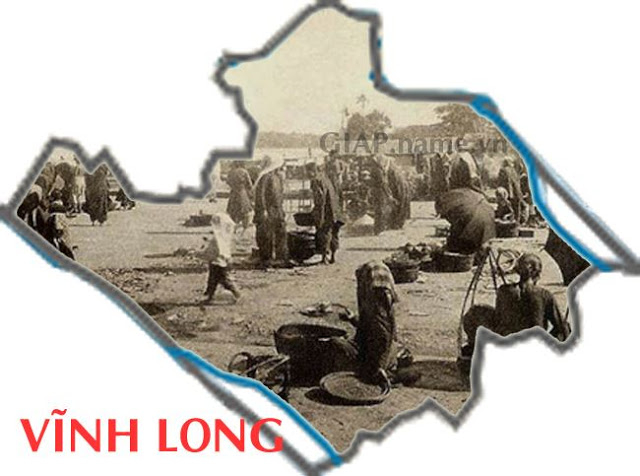
60. Vinh Long
In the Sino-Vietnamese language
Vinh Long has many meanings, which can mean:
"prosperity (Long) lasting, forever (Vinh)". The name Vinh Long, once called
Vang Long, however difficult to explain the semantic relationship, because the
meaning of "Vang" gone, passed, often "not consistent with the meaning of
"Vinh", as in the compound word "Vinh Long". It is possible to explain the path
of phonetic conversion to make it easier to pronounce, many words also change
from Inh to Ang.
In the photo is the entertainment center Bungalow (Cong Quan) built by the
French in Vinh Long around 1900, across the river is Ward 5 today.
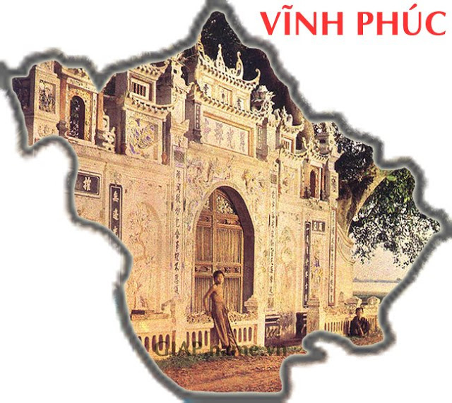
61. Vinh Phuc
Vinh Phuc was established on 12 February1950 by combining the two provinces of
Vinh Yen and Phuc Yen, but due to many splits and mergers, Vinh Phuc now
includes Vinh Yen province and Phuc Yen town before. During the period when the
French temporarily occupied the North in the period 1946-1954, the province was
also known as Vinh Phuc Yen province.
In the photo is a temple on the way to Tam Dao, taken in June 1916.
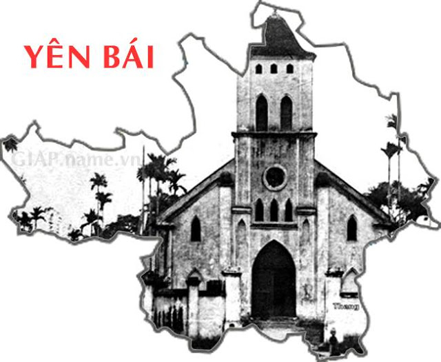
62. Yen Bai
Yen Bai is the name taken from the village name Yen Bai, on April 11, 1900 the
French colonialists established Yen Bai province, comprising Tran Yen district,
two districts Van Chan, Van Ban and provincial town located in Yen Bai village.
From 1910 - 1920 moved Luc Yen district (Tuyen Quang province) and Than Uyen
district (Lai Chau province) into Yen Bai province. Since 1945, there have been
many splits and mergers of a part or the whole province.
In the photo is Yen Bai cathedral in 1910.

Vietnam Travel Information
Customize your trip

Testimonials
Dear Ms Helen Pham
We had a wonderful amazing trip and will return as soon as we can afford it again. Thank you so much! I will write a great review on tripadvisor. Really the guides and hotels and tours were awesome. Ms. Nhung was very sweet and refreshingly honest, very likeable. Mr. Tam was fantastic, highly knowledgeable and funny. Probably our best "tour" was the day we spent on motor bikes visiting the tombs near Hue. The bikes allow for a much more intimate view of the countryside. And then - as I wrote - Mr. An was absolutely the best guide ever...Read more